
Lesson: How We Tell Where We Are – From Longitude to Time Zones
1. Finding Our Place on Earth
Before we could talk across oceans or fly in airplanes, people needed to answer a big question:
How do we know exactly where we are on Earth?
Early sailors could figure out north and south by looking at the stars and the Sun. But east and west were much harder to measure. This became known as “the greatest riddle of all time” — the problem of longitude.
2. The Story of Longitude
- Latitude (north-south) was easier. Sailors used the angle of the Sun at noon or the North Star at night to measure how far north or south they were.
- Longitude (east-west) was the real challenge. There were no fixed stars to guide direction. Sailors often got lost or shipwrecked because they couldn’t measure it.
- The solution came with clocks. In the 1700s, John Harrison invented a clock that could keep accurate time at sea. By comparing the time on the ship to the time at Greenwich (England), sailors could calculate how far east or west they were.
- This invention changed navigation, trade, and exploration forever.
3. The Compass Directions
To understand location, we also need the four main compass points:
- North (N) – towards the North Pole.
- South (S) – towards the South Pole.
- East (E) – the direction the Earth rotates, where the Sun rises.
- West (W) – where the Sun sets.
Together these directions help us orient ourselves on maps and in real life.
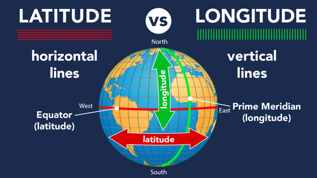
4. Degrees of the Earth
- The Earth is a sphere divided into 360 degrees.
- Latitude lines run horizontally:
- Equator = 0°
- North Pole = 90° N
- South Pole = 90° S
- Longitude lines run vertically:
- Greenwich (London) is at 0° longitude – the Prime Meridian.
- East and west of Greenwich are measured up to 180°.
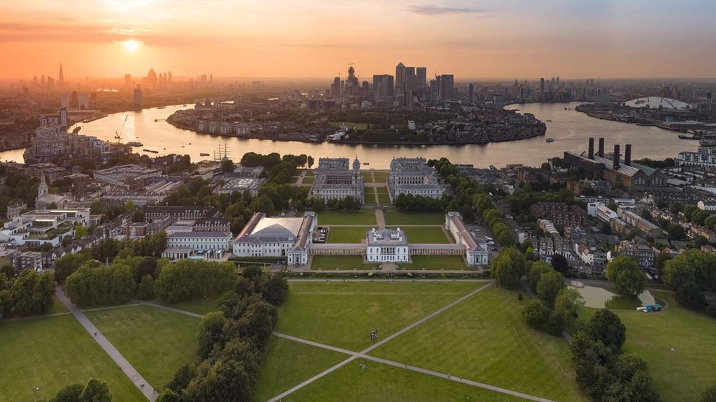
This grid of latitude and longitude lets us pinpoint any location on Earth.
5. Time and the Earth’s Rotation
- The Earth rotates once every 24 hours.
- It spins through 360°.
- That means every 15° of longitude = about 1 hour of time.
- This is why the world is divided into 24 time zones.
Example:
- When it’s 12:00 noon in Greenwich (0°), it’s 14:00 (2 PM) in South Africa (UTC+2).
- When it’s noon in Greenwich, it’s already 21:00 (9 PM) in Tokyo (UTC+9).
6. Why This Matters for Ham Radio
Amateur radio operators need to know the exact time when they talk to someone on the other side of the world. That’s why they use UTC (Coordinated Universal Time) — the global clock based on the Prime Meridian in Greenwich.
It means everyone is “on the same page,” no matter what time zone they live in.
How Time Zones Work
- When it’s 12:00 UTC (noon) in Greenwich, it’s:
- 14:00 in Johannesburg (UTC+2)
- 07:00 in New York (UTC–5)
- 21:00 in Tokyo (UTC+9)
This is why UTC is essential in international communication — everyone can convert from the same “base clock.”
Look at this Map:
https://www.timeanddate.com/time/map/
- What time is it now in South Africa? UCT time _________
- What time is it now in Stockholm Sweden? UCT time _________
- What time is it now in Yapur India UCT time _________
- What time is it now in Knoxville USA in UCT time _________
- What time is it now in Sydney Australia? UCT time _________
7. Key Takeaways
- North, South, East, West give us basic direction.
- Latitude = north/south; Longitude = east/west.
- The Prime Meridian at Greenwich is the starting point for longitude.
- Accurate clocks solved the “longitude problem” and made safe travel possible.
- The Earth is divided into 24 time zones, each about 15° of longitude wide.
- UTC is the world’s common time, used in science, aviation, and amateur radio.